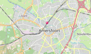
The old town of Amersfoort east of Utrecht, is built inside the old defence ring. Remains of settlements in the Amersfoort area from around 1000 BC have been found, but the name Amersfoort, after a ford in the Amer River, today called the Eem, did not appear until the 11th century.
The city grew around what is now known as the central square, the Hof, where the bishops of Utrecht established a court in order to control the “Gelderse Vallei” area. It was granted city rights in 1259 by the bishop of Utrecht, Henry I van Vianden. A first defensive wall, made out of brick, was finished around 1300.
Soon after, the need for enlargement of the city became apparent and around 1380 the construction of a new wall was begun and completed around 1450. The famous Koppelpoort, a combined land and water gate, is part of this second wall. The first wall was demolished and houses were built in its place.
The Onze-Lieve-Vrouwentoren (Tower of Our Lady) is one of the tallest medieval church towers in the Netherlands at 98 m. When it was built, it was the middle point of the Netherlands, it was exactly built in the center and a reference for the Dutch grid system. The nickname of the tower is Lange Jan (“Long John”).
The inner city of Amersfoort has been preserved well since the Middle Ages. Apart from the Onze-Lieve-Vrouwetoren, the Koppelpoort, and the Muurhuizen (Wall-houses), there is also the Sint-Joriskerk (Saint George’s church), the canal-system with its bridges, as well as medieval and other old buildings; many are designated as national monuments. In the Middle Ages, Amersfoort was an important centre for the textile industry, and there were a large number of breweries.
Main sights
- Onze Lieve Vrouwetoren: (Tower of Our Lady) is an old chapel.
- Koppelpoort: One of the three surviving city gates.

-Koppelpoort.hero.landscape.jpg?w=1600)

-Koppelpoort.jpg?w=256)
.jpg?w=256)
-Monnikendam.jpg?w=256)
-Koppelpoort.jpg?w=256)
-Kamperbinnenpoort.jpg?w=256)
.jpg?w=256)
-Onze-Lieve-Vrouwetoren.jpg?w=256)
-Onze-Lieve-Vrouwetoren.jpg?w=256)
-Monnikendam.jpg?w=256)
-Monnikendam.jpg?w=256)
-Koppelpoort.jpg?w=256)
.jpg?w=256)
-Koppelpoort.jpg?w=256)
.jpg?w=256)
.hero.jpg?w=320)
